Overview
Since 2020, two applied courses in digital archaeology offered by the Center for the Analysis of Archaeological Materials (CAAM) and sponsored by the Netter Center for Community Partnerships have emphasized work relating to African American cemeteries in southeast Pennsylvania, providing students with the opportunity to acquire skills in digital field recording and analysis to help tell the story of greater Philadelphia’s Black burial spaces. In these courses, Introduction to Digital Archaeology and Geophysical Prospection for Archaeology, practical lessons are designed to connect students with interested groups who are associated with African-American cemeteries to:
- Identify cultural resource issues that can be addressed with digital methods
- Design and carry out investigations or analyses
- Synthesize and present their results

Rationale
During the 19th and 20th centuries, dozens of cemeteries in Philadelphia were overtaken by urban expansion and development, while others were left neglected as their related communities were displaced through hostile policies. This pattern is not unique to Philadelphia and is the subject of a nationwide effort to restore African American cultural heritage. As a discipline that can recreate unwritten histories, archaeology can help empower communities to reconstruct their stories and reclaim historical spaces (Montgomery et al. 2023).
Above is a map of Philadelphia’s existing and past burial places, built on a spatial database first compiled by the Philadelphia Archaeological Forum. In our courses, students used a geographic information system to relate spatial and non-spatial data and to experiment with visualization.
Collaborators
Between 2020 and 2023, course work focused on three sites in southeast Pennsylvania: Mt. Zion AME Church in Devon, the former Ebenezer AME in Frazer, and Historic Eden Cemetery in Collingdale. The primary objectives of student work and exercises at these sites is to reconstruct the original plans, layout, and histories of these spaces, to interpret our data in the context of broader histories of threatened and lost African American mortuary landscapes, and to share and develop our interpretations with the individuals and communities who care for them today.
Methods
Cemeteries are well-suited for teaching field archaeology as built landscapes where material remains are easily accessed and readily connected to textual evidence. Digital approaches benefit from the fact that they are commonly non-invasive, repeatable, and non-destructive. Moreover, the products of digital surveys present rich images that often do not require specialized training for interpretation, offering an avenue for engagement with our partners and the public.
Specific skills that are taught in CAAM community-oriented digital archaeology courses include:
- Digital data recording and management
- Spatial data management and analysis in a geographic information system (GIS)
- Topographic and aerial survey techniques
- 3D data collection and processing
- Geophysical survey
- Digital data communication and dissemination
Outcomes
In both courses, students are introduced to digital tools and methods through a series of exercises. At the end of the semester, each student submits a final project that integrates two or more of the techniques covered in class. Some of these techniques and examples of student work and our collective efforts are presented below.
Mapping and Recording
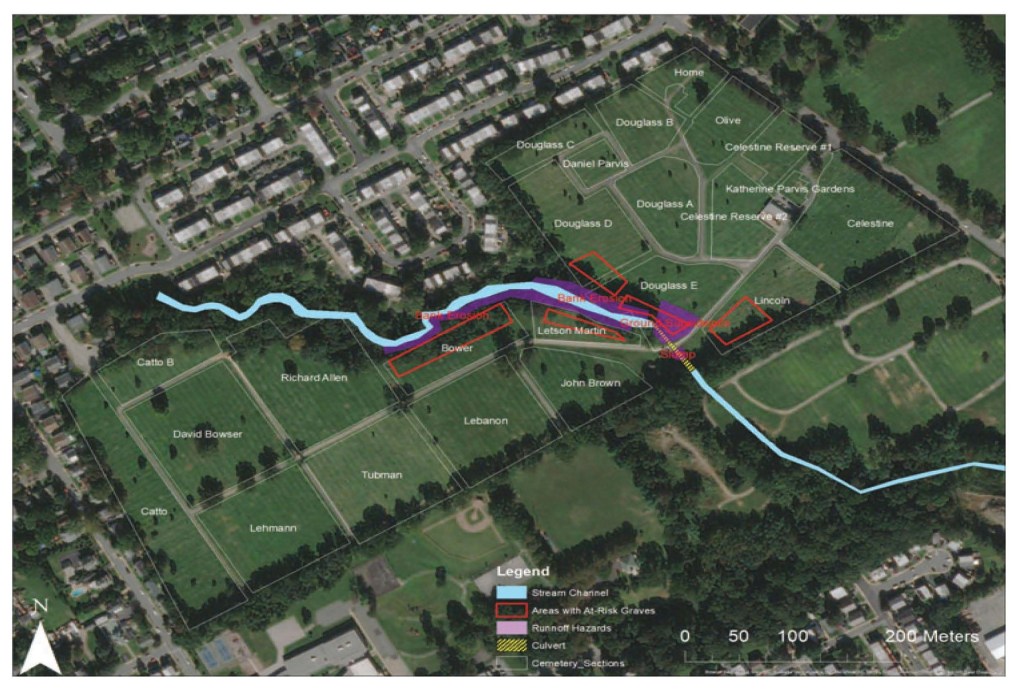
Students explore how digital data management systems and geographic information systems (GIS) can be used record field data, integrate multiple datasets, and analyze patterns.
One student project, by former CAAM student Vaughn Ortner, brings together scanned plan maps, historic imagery, and public lidar data to create a flood risk map of Eden Cemetery in Collingdale, PA (after Ortner and Herrmann 2021)
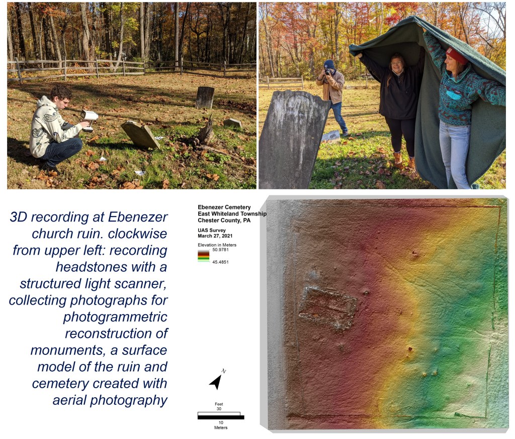
3D Data Capture and Visualization
Students practice creating and manipulating 3D models of the landscape and the built environment. 3D based analyses are useful for reconstructing past objects and environments or for highlighting subtle surface features that have been affected by erosion.
Geophysical Survey
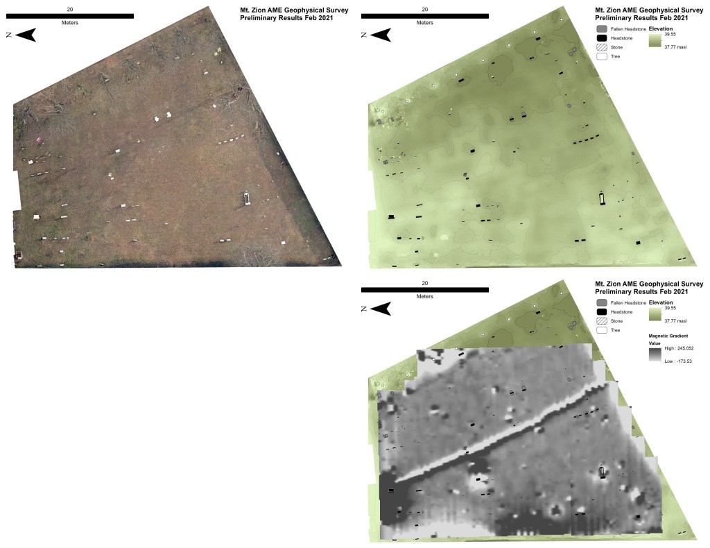
Near-surface geophysics including magnetic gradiometry, electrical resistance, and ground-penetrating radar (GPR) are useful not only to locate unmarked burials, but to map evidence of past built and natural landscapes.
Shown at left are some examples of landscape-based investigations at Mt Zion AME cemetery. Clockwise from upper left: an aerial orthomosaic, photogrammetry-derived elevation map of the cemetery showing distribution of depressions and headstones, and a map of magnetic intensity showing the presence of a buried electrical line that crosscuts the cemetery and some burial positions.
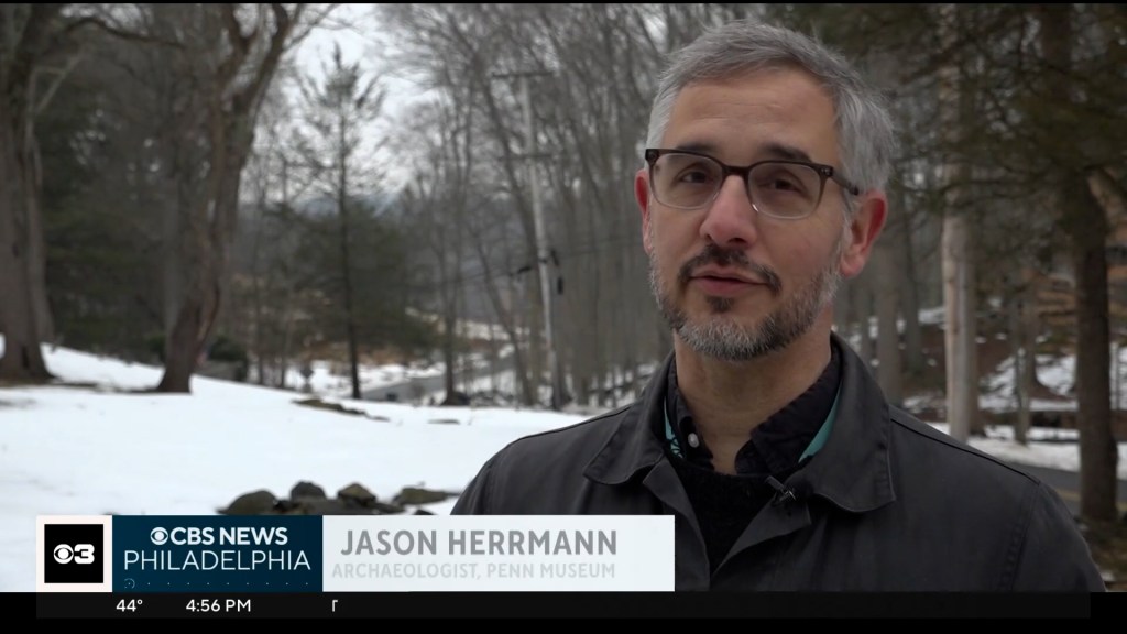
CBS Philadelphia segment on Preservation at Archie’s Corner. aired March 6, 2026
- Netter Center for Community Partnerships
- Pennsylvania Hallowed Grounds
- Dr. Steven Burg
- Barbara Barksdale
- Bertha Jackmon and Rev. April Martin of Mt Zion AME Church, Devon, PA.
- Sheila Jones of Historic Eden Cemetery, Collingdale, PA.
- Doug Mooney, Philadelphia Archaeological Forum.
References
Montgomery, Lindsay M., Anna S. Agbe-Davies, Cipolla, Stephen Mrozowski, Nate Acebo, Stacey Camp, Wade Campbell, et al. 2023. “Advocating for Archaeology’s New Purpose.” SAPIENS, March 15, 2023. https://www.sapiens.org/archaeology/archaeological-reclamation/.
Ortner, Vaughn, and Jason T. Herrmann. “Protecting Cultural Landscapes: Using Digital Tools to Understand the Historical Context for Runoff Damage at Eden Cemetery (Collingdale, PA).” Submitted for University of Pennsylvania course: Introduction to Digital Archaeology.
About CAAM
A joint endeavor between the Penn Museum and the University of Pennsylvania’s School of Arts and Sciences, CAAM is a center for research in the archaeological sciences that provides applied courses, laboratory and classroom facilities, materials, and equipment.
